ΑΝΑΒΑΣΗ ΣΤΟΝ ΧΡΙΣΤΟ, ΔΙΚΑΙΟΣ


 Κεφάλαιο Β'- Η διαδρομή


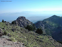




Κεφάλαιο Ε'-Το ξωκκλήσι του Χριστού (Μεταμόρφωση Σωτήρος)


Chapter E – The Chapel of Christ (Transfiguration of the Saviour)

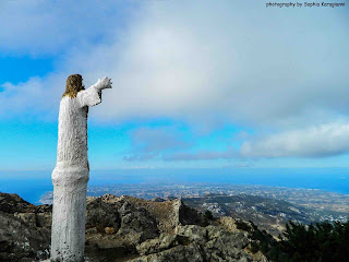
το ναΰδριο του Χριστού το 2012
Η ανάβαση στον Χριστό στον Δίκαιο είναι μία τελετουργία. Δεν υπάρχει Κώος που να σέβεται τον εαυτό του που να μην έχει ανέβει τουλάχιστον μία φορά στη ζωή του στον Χριστό.Στη Ζια βρίσκεται το σημείο εκκίνησης. Μπορείς να ανέβεις κι από την Κεφαλόβρυση αλλά καλύτερα να ξεκινήσεις από την πηγή γιατί η σήμανση είναι σαφώς καλύτερη. Η συνηθέστερη μέρα για ν' ανέβει κανείς στον Χριστό είναι παραμονή της ονομαστικής του εορτής (η γιορτή είναι 6 Αυγούστου, η ανάβαση γίνεται στις 5). Δεκάδες πιστοί συρρέουν και μάλιστα κάποιοι απ' αυτούς-οι πιο τολμηροί- διανυκτερεύουν εκεί.


Κεφάλαιο Α'- Η Σήμανση
Πρόκειται για ένα από τα μετρημένα στα δάχτυλα καλοσχηματισμένα και σημαδεμένα μονοπάτια του νησιού, δύσκολα θα χαθείς, ακόμη κι αν προσπαθήσεις. Ως την κορυφή Χριστός του Δικαίου, 843 μ (λανθασμένα πιστεύεται ότι είναι η ψηλότερη κορυφή του Δικαίου, στην πραγματικότητα το Ψηλό Βουνό είναι 846 μ.), υπάρχουν πάνω από δέκα πινακίδες που σου δείχνουν τον δρόμο.


Η ανάβαση θα πάρει περίπου μία ώρα, τα 45' στο μονοπάτι και 15΄ σε δασικό δρόμο σε μία μέτρια πεζοπορική διαδρομή. Φυσικά, αν είναι η πρώτη φορά που περπατάς ή κάνεις το λάθος να μην ξεκινήσεις ξημερώματα, μπορεί να πάρει και δύο ώρες η ανάβαση.
Λείψανα μεσαιωνικού οικισμού, δεξαμενές νερού, ασβεστοκάμινα, οπτόπλινθοι και άφθονα πήλινα όστρακα που προέρχονται από διάφορες εποχές φανερώνουν έντονη ανθρώπινη δραστηριότητα στην περιοχή κατά τους αρχαίους και μέσους χρόνους. Ο κύριος ορεινός όγκος του Δίκαιου δομείται από ασβεστόλιθους και μάρμαρα, καθώς και μεγάλες μάζες πλουτωνιτών και ηφαιστιτών. Στην επαφή των ηφαιστιτών με τους ασβεστόλιθους και τα μάρμαρα αναπτύσσεται κατά τόπους μεταλλοφορία, με χαρακτηριστικές αποθέσεις πολύχρωμων οξειδίων μετάλλων.


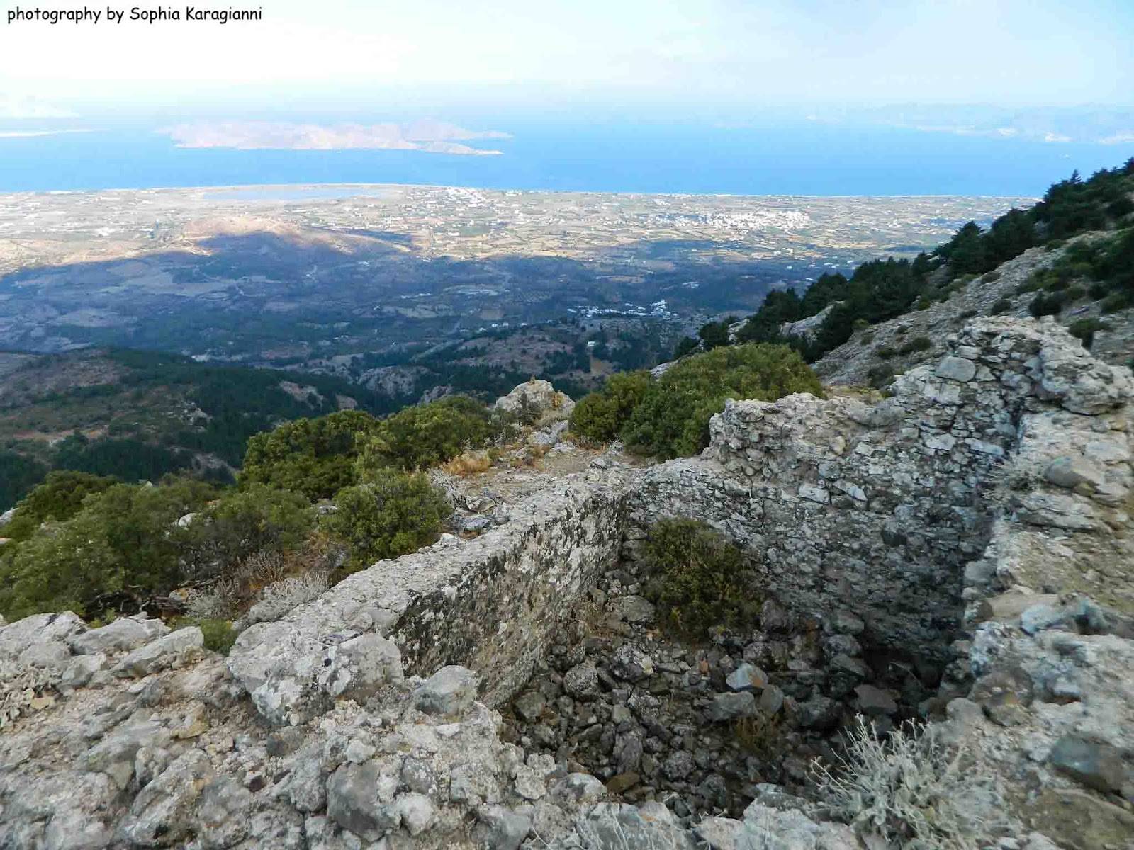 |
| ασβεστοκάμινο |


 |
| Λείψανα μεσαιωνικού οικισμού |


Κεφάλαιο Γ'- Η θέα
Το όρος Δίκαιος, γνωστό στους αρχαίους ως Ωρομέδων, Ωρίων ή Δίκαιον, είναι το ψηλότερο βουνό της Κω, με υψόμετρο 846 μ. Η προέλευση του ονόματός του είναι άγνωστη.
Η κατανομή των υψομέτρων είναι ασύμμετρη. Στα νότια της κορυφογραμμής και σε απόσταση το πολύ 2 χλμ., το όρος έχει μεγάλη κλίση προς τη θάλασσα. Αντίθετα, η απόσταση ανάμεσα στην κορυφογραμμή και την ακτή βορείως του άξονα του όρους είναι 6-7 χλμ. Το ίδιο το σχήμα του νησιού καθορίζεται από τους άξονες των πτυχώσεων και την κατεύθυνση των ρηγμάτων, ενώ οι ρεματιές έχουν κατεύθυνση κάθετη προς αυτήν, όπως φαίνεται γύρω από την κορυφή του Δίκαιου προς την πλευρά του Ασφενδιού.
Η θέα είναι ασύλληπτη. Σε μια μέρα με καθαρή ατμόσφαιρα φαίνονται τα μισά νησιά του Αιγαίου, όσο ανεβαίνεις σ' ακολουθεί η εικόνα της Αλυκής και της Ψερίμου κ μετά έρχεται το Γυαλί κι η Νίσυρος αλλά κι η Καρδάμαινα από ψηλά.


Κεφάλαιο Δ'- Η κορυφή
Αγγίζοντας την κορυφή δημιουργείται στον επισκέπτη μία αίσθηση απεραντοσύνης. Το μεγαλείο της φύσης, η υπέροχη θέα, η ανάβαση προς τον Χριστό σε κάνουν να νιώθεις λίγο πιο κοντά στο Θεό. Φτάνοντας στον θεόρατο Σταυρό που φάνταζε μικροσκοπικός όταν ξεκινούσες θέλεις να σταθείς με τα χέρια προς τον ουρανό και να φωνάξεις "I'm the king of the world". Κι αν πετύχεις και το ηλιοβασίλεμα, ε, τότε τα έχεις δει όλα.


 |
| ηλιοβασίλεμα στον Δίκαιο το 1997 |


 |
| ο ιστός της σημαίας στέκει μόνος |

 |
| στην κορυφή του Δικαίου πριν και μετά την εικαστική παρέμβαση του Μιχ. Κουτσουμπάρη το 2012 |


 |
| ομάδα πεζοπόρων μόλις έχει φτάσει στην κορυφή τον Οκτώβριο του 2012 |

Στην κορυφή του όρους Δικαίου είχε χτίσει πριν το 1079 δυο κελιά ο Κώος Μοναχός Αρσένιος Σκηνούρης και ασκήτευε με ελάχιστους μοναχούς. Λίγο αργότερα χτίστηκε εκεί το εκκλησάκι του Χριστού και συγκροτήθηκε η Μονή του Σωτήρος Χριστού, η οποία το 13ο αιώνα έγινε Μετόχι της Μονής Πάτμου.

Το ναΰδριο της Μεταμορφώσεως είναι μονόχωρο, καμαροσκεπές κτίσμα με εξωτερικές διαστάσεις 4,80Χ3,30 μ. περίπου. Στην οροφή του ναού υψώνεται συνεπτυγμένος τρούλος, με διάμετρο πολύ μικρότερη από το πλάτος του ναού. Η τοιχοποιία είναι από αργολιθοδομή. Οι επιφάνειες των τοίχων καλύπτονται εσωτερικά με ασβεστοκονίαμα, κάτω από το οποίο παλαιότερα διακρίνονταν λείψανα από τοιχογραφίες.

Το ναΰδριο έχει υποστεί κατά καιρούς ανακατασκευαστικές επεμβάσεις. Η χάρη και η δεσπόζουσα θέση του προσελκύουν πάντοτε πλήθη εντοπίων και ξένων ιδιαίτερα κατά την ημέρα της εορτής του (6 Αυγούστου) και την παραμονή. Η θέα και από το εκκλησάκι είναι μοναδική.
Σύμφωνα με τον Καρπάθιο, το 1955 έπεσε κεραυνός πάνω στο εκκλησάκι, το οποίο είχε ήδη βλάβες, κι έτσι καταστράφηκε. Με πολλή προσπάθεια από την Εκκλησιαστική Επιτροπή Κοιμήσεως Θεοτόκου Ζιας και με συνεισφορά των ιερών ναών του νησιού, προσωπικά των ιερέων του νησιού, των ενοριτών και των τρόφιμων των Σχολών Ανταρτοπαίδων, τελείωσε η επισκευή τον Ιούλιο του 1955 και το ξωκκλήσι τέθηκε πάλι σε λειτουργία.
 |
| το ναΰδριο το 1997 |
 |
| το ναΰδριο το 2005 |

Βόρεια του ναού σώζεται μικρό κτίσμα, παλαιό κελί. Στην αυλή ΝΔ υπάρχει κτιστή υπόγεια δεξαμενή (Κιστέρνα). Σε απόσταση 25 μ. περίπου ΝΔ του ναού φαίνονται λείψανα κελιών, όπου ίσως διανυκτέρευαν στα παλαιά χρόνια οι προσκυνητές.


Η διαδρομή με Gps: http://el.wikiloc.com/wikiloc/view.do?id=1134833
Πηγή: Το Ασφενδιού της Κω-Μανόλη Σ. Κιαπόκα
"Εκκλησία Κω Δωδεκανήσου"-Τόμος Πρώτος, βιβλίον Δεύτερον, Αθήνα 1969-Εμμανουήλ Ι. Καρπάθιου (Μητροπολίτου Μεσημβρίας της επί Ευξείνω)
Κείμενο, Φωτογραφίες: Sophia Karagianni
Ακολουθεί η μετάφραση του κειμένου στα αγγλικά:
ASCENT TO CHRIST THE SAVIOUR, MOUNT DIKAIOS
The chapel of Christ the Saviour in 2012
The ascent to Christ the Saviour on Mount Dikaios is a ritual. There is hardly a local of Kos who has not climbed to Christ at least once in their lifetime.
The starting point is in Zia. You can also begin from Kefalovrysi, but it is preferable to start from the spring, as the trail is much better marked. The most popular day to make the ascent is the eve of the Feast of the Transfiguration (the feast is celebrated on 6 August, while the climb traditionally takes place on 5 August). Dozens of pilgrims make the journey, and some of the more adventurous even spend the night at the summit.
Chapter A – The Trail Markings
This is one of the very few well-designed and clearly marked hiking trails on the island. It would be difficult to lose your way, even if you tried. Along the route to the summit of Christ on Mount Dikaios (843 m)—which is mistakenly believed to be the highest peak of the mountain, whereas Psilo Vouno actually reaches 846 m—there are more than ten signs directing hikers along the trail.
Chapter B – The Route
The ascent takes approximately one hour: about 45 minutes on the footpath and another 15 minutes along a forest road, making it a hike of moderate difficulty. Naturally, if it is your first hiking experience or if you make the mistake of setting off after sunrise rather than at dawn, the climb may take up to two hours.
The remains of a medieval settlement, water cisterns, lime kilns, bricks, and abundant pottery sherds dating from various periods testify to intense human activity in the area throughout antiquity and the Middle Ages. The main mountain mass of Dikaios consists of limestone and marble, together with large bodies of plutonic and volcanic rocks. At the contact zones between the volcanic rocks and the limestone and marble, mineralisation occurs in places, producing characteristic deposits of multicoloured metal oxides.
Lime kiln
Remains of a medieval settlement
Chapter C – The View
Mount Dikaios, known in antiquity as Oromedon, Orion, or Dikaion, is the highest mountain on Kos, with an elevation of 846 metres. The origin of its modern name remains unknown.
The distribution of its elevations is asymmetrical. South of the ridgeline, the mountain descends steeply towards the sea within no more than two kilometres. By contrast, the distance between the ridge and the northern coastline is six to seven kilometres. The shape of the island itself is determined by the axes of its folds and the orientation of its fault lines, while the valleys run perpendicular to them, as can be seen around the summit of Dikaios towards Asfendiou.
The view is breathtaking. On a clear day, nearly half the islands of the Aegean can be seen. As you climb, the Alykes Salt Lake and Pserimos accompany you in the distance; further on, Gyali and Nisyros come into view, along with Kardamaina seen from high above.
Chapter D – The Summit
Reaching the summit fills visitors with a profound sense of vastness. The grandeur of nature, the magnificent panorama, and the climb itself bring you a little closer to God. When you finally reach the towering Cross—which looked tiny when you first set out—you feel like standing with your arms stretched towards the sky and shouting, "I'm the king of the world!"
And if you are fortunate enough to witness the sunset from the summit—well, then you have truly seen it all.
Sunset on Mount Dikaios, 1997
The flagpole now stands alone.
The summit of Mount Dikaios before and after the artistic intervention by Michalis Koutsoubaris in 2012.
A group of hikers having just reached the summit in October 2012.
At the summit of Mount Dikaios, the monk Arsenios Skinouris, a native of Kos, built two monastic cells before 1079 and lived there as a hermit with only a few fellow monks. Shortly afterwards, the small chapel of Christ was erected, and the Monastery of Christ the Saviour was established. During the 13th century, it became a dependency (metochion) of the Monastery of Patmos.
The Chapel of the Transfiguration is a small, single-aisled, barrel-vaulted building measuring approximately 4.80 × 3.30 metres externally. A compact dome rises above the roof, its diameter considerably smaller than the width of the chapel. The masonry consists of irregular stonework. The interior walls are coated with lime plaster, beneath which traces of wall paintings were once visible.
Over the centuries, the chapel has undergone several phases of reconstruction. Its charm and commanding position continue to attract large numbers of both local residents and visitors, especially on the eve of and during its feast day, 6 August. The panoramic view from the chapel is equally spectacular.
According to Karpathios, lightning struck the chapel in 1955. Since the building had already suffered structural damage, the strike caused extensive destruction. Through the determined efforts of the Ecclesiastical Committee of the Church of the Dormition of the Theotokos in Zia, together with contributions from the churches of Kos, the island's clergy, local parishioners, and the residents of the Schools for Young Partisans, the restoration was completed in July 1955, and the chapel was returned to active use.
The chapel in 1997.
The chapel in 2005.
North of the chapel stands a small surviving building, an old monastic cell. In the courtyard to the southwest there is a built underground cistern. Approximately 25 metres southwest of the chapel are the remains of additional monastic cells, where pilgrims may once have spent the night in earlier times.

Δεν υπάρχουν σχόλια:
Δημοσίευση σχολίου